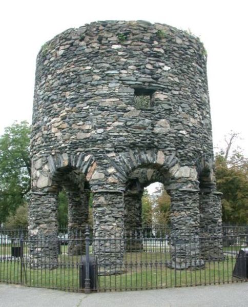

Developments in Newport Tower
There have been two recent developments I wanted to share.
The first adds credence to the theory that the Newport Tower
Cartography
Renowned anthropologist and researcher Dr. Gunnar Thompson recently passed away, but before he did he posted to his website ( http://marcopoloinseattle.com ) a number of maps of the

The map clearly displays a European settlement at the northeastern
end of Narragansett Bay, labeling the settlement “Norombega” and describing the
settlement (not shown) as the capital city of the New
World . Apparently, as of 1569, there was known to be a
well-established European presence in the Newport Newport Roanoke Newport
The conclusion that the

Recall that Plymouth Colony was settled in 1620 by the
Pilgrims. And note the label “New Plymouth” located east of Plymouth Harbor
in Cape Cod Bay (you may need to zoom in) Narragansett Bay , where
Mercator marked Norombega, there is a settlement labeled “Old Plymouth” on this
map (again, zoom in). The first Colonial settlers did not arrive in Rhode Island Narragansett Bay area.
Of course, these maps don’t prove that the
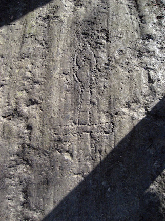
Native American Oral History
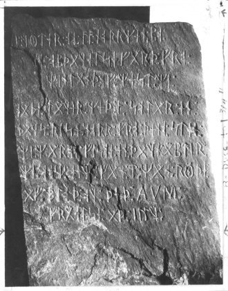
So if the Tower predates the Colonists, who built it?
Readers of my books know that I believe the leading candidate to have done so was
Prince Henry Sinclair and his party in or around 1399. (Sinclair ruled Scottish
lands near Edinburgh as wells as Norwegian lands
in the Orkney Islands ; his family also had a
longstanding relationship with the outlawed Knights Templar.) In previous
posts, and in my books and lectures, I have outlined the various reasons for
this. But, until recently, I had never asked the one group of people who were
actually here when I believe the Tower was built: The Native Americans.
In June of 2015, Pocasset Wampanoag Tribal Chief Daryl
“Black Eagle” Jamieson joined a group of us at the Tower. When asked, Black Eagle replied that, according
to what had been passed down to him by tribal elders, the Tower had been build
by Henry Sinclair and the Knights Templar. He pointed out that whoever built
the Tower must have had an alliance with the Native Americans in the area
(ruling out the Colonists and also the Elizabethan-era British), else the
Native Americans simply would have driven them off long before the Tower could
have been completed. (A more complete excerpt of Black Eagle’s response is set
forth below.)
My sincere thanks to Black Eagle for his candor and his willingness to help us solve the mystery of who built this amazing Tower.
**************************************
Black Eagle comments June, 2015:
“The Narragansett history is that the people that built this
Tower are people that came here with red hair... They were red-haired people
building here and they were allowed to build here—allowed... To me, the only
person that could have came here and gotten away with that is somebody that was
brought here by another native tribe... They would have had to have had some
kind of alliance... The only ones that I know that had that alliance were Henry
Sinclair when he came and met with the Micmacs.* The Knights Templar. They were
the only legitimate people that could have come here and built this with the
permission of the natives.”
*It is believed the Prince Henry group made an alliance with the Micmacs of Nova Scotia before coming south to New England.
13 comments:
Interesting
Great findings. I've always been intrigued by the Newport Tower amd pre-Columbian expeditions to the the New World.
Thanks, Jason. This seems like one of those mysteries where the deeper you dig, the more you find...
Enjoyed your narrative about Westford Knight. About 50 years ago ( 1970 ) I lived in Westford behind new high school on what was then " Cemetery Road" I know they changed the name. Visited the Westford Knight carving and always wondered why nobody had ever done a dig. I realize you would have to block the road for a brief period but LIDAR might focus the excavation area. Never knew of the " Boat " stone. Was it in Library at that time ?
Hi Craig. Regarding a dig, the road has been widened in that area and water/gas lines installed beneath the street. It is likely that anything that may have been buried is long gone. Boat Stone came to Library in the late 1960s, I believe, so you probably just missed it. Glad you enjoyed the story!
Hi David, interesting read. Have you heard of the tower in Lakeville, Massachusetts? It's located close to the Assawompset Pond Complex and it's believed to have been built to serve as a water tower for a Sailor's home in 1882, however a stonemason believes the mortar isn't original and it could be much older. https://wbsm.com/lakeville-tower-mundane-mystery/
I have not seen the tower in Lakeville. Interesting point in the article about Powder House Road nearby. I similar tower (Colonial era) in Somerville is located at Powderhouse Circle.
Yes, the tower in Lakeville is very interesting when you consider all the different factors and dynamics surrounding it. It's relatively close to the Narragansett Bay area and the Assawompset Pond complex nearby is obviously a significant natural resource and archaeological site of the Wampanoag Tribe. It's also interesting to note it's directly next to the "Heritage Hill" Golf Course. The entire story surrounding the tower is strange and in my opinion, just doesn't quite add up correctly. It's also worth noting the May Flower Lodge A.F. & A.M. is located in the neighboring town of Middleboro.
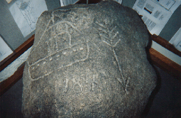
Hi David, checking back in with some more information you may find interesting! The Town of Middleborough, Massachusetts was officially settled by Europeans in 1661, but our history goes back well before the actual founding of the town. According to local historian, Dorothy Thayer:
“Excavations by Dr. Maurice Robbins of Attleboro, Massachusetts, at the area near the mouth of the Nemasket River, have revealed an Archaic Village in Middleborough that dates back to at least 2300 BC. This date has been substantiated by radiocarbon dating. Also a rock located to the East of the mouth of the Nemasket River, revealed only when the waters of Lake Assawompset are low, showed a mysterious sign of presence of Mediterranean people. On the rock is a picture of a Phoenician ship. It was carved by some awe-filled Indian, who saw the ship anchored in the lake and was moved to record his sighting for all to see.”
In 1661, the town was named Nemasket but then later changed to Middlebury and officially incorporated as Middleborough in 1669. The name Nemasket came from a Native American settlement along the small river that now bears the same name. Nemasket may have meant "place of fish," due to the large amount of herring that migrate up the river each spring. The name Middlebury was taken from a place in England, and changed to the more modern Middleborough.
(Source: https://www.middleboroughma.gov/304/History)
We know the Knights Templar and the Phoenicians had a connection through Solomon's Temple. The Knights Templar were named after this temple, and the Phoenicians, particularly the King of Tyre, provided resources and skilled labor for its construction. The Phoenicians also played a role in building other structures and developing skills that influenced the Templars and other societies.
Wow, I had not heard of this Phoenician ship carving. Have you ever seen it? Is there a time when the lake level is low? Would love to check that out!
I have not seen the Phonecian ship petroglyph with my own eyes, but I managed to find a photo of it posted on Facebook: https://m.facebook.com/photo.php?fbid=10227713890807091 However, I have seen a petroglyph of some kind of circumpunct symbol when the waters of Assawompset were relatively low in October of last year.
Nice find! I am friendly with Derek, so hopefully I can get him to lead me to it.
Thanks, I truly believe this information is extremely important and significant in relation to the theory of Knights Templar exploration of North America before Columbus. The water level at the Assawompset Pond complex is currently high, but I would still highly recommend visiting the area and hiking some of the surrounding trails to experience the energy of the area for yourself. If you're very lucky, you might be able to spot some of the nesting Bald Eagles in the area. Legend has it they are carefully guarding and watching over this sacred Wampanoag area so I wish you the best of luck in your adventures and research!
Post a Comment